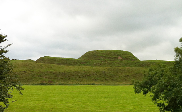
A view of the Motte from the River shows the Motte and Bailey very clearly. Sometimes standing back makes things clearer than being right on the mounds.
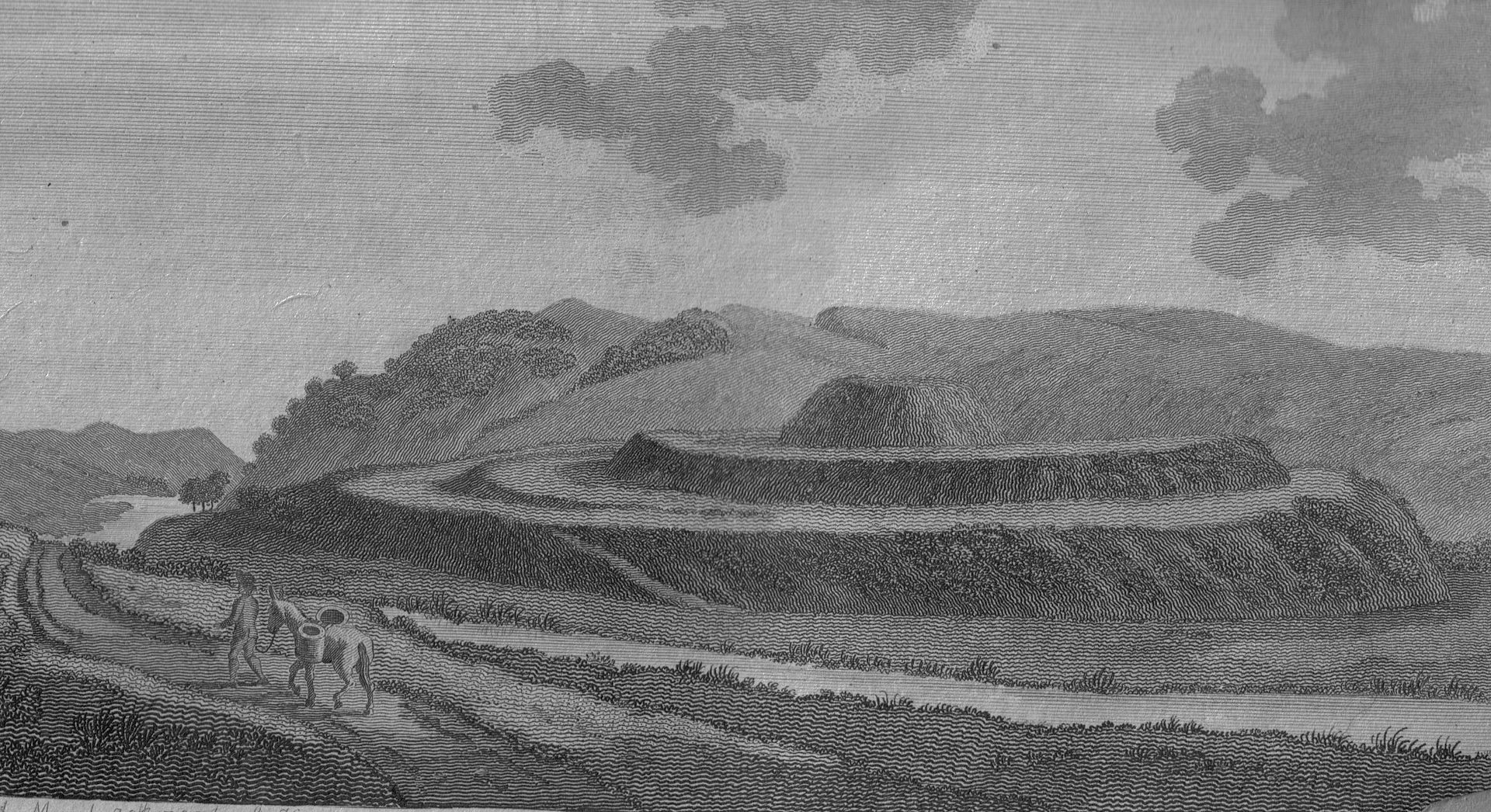
Motte of Urr – 1797 Drawing. Its a tad more worn down now.
A Description Extract from the Web:
THE MOTTE OF URR, Nr. DALBEATTIE, DUMFRIES & GALLOWAY, SCOTLAND
A 12th century `motte and bailey ` construction – a fortified area, built on rising ground with earthworks creating a deep and wide ditch around it, is on the outskirts of Dalbeattie. The buildings on the mound and the fence round it would have been constructed from wood. Remnants of burnt wood have been found dating back to the 12th century and signs were found that the fortifications were subsequently rebuilt.
The Motte of Urr is said to be the most extensive motte and bailey castle in Scotland and may well have been built on the site of an earlier Anglo Saxon fort. It is relevant that the Vikings made use of the motte and bailey fortification for their temporary accommodation during raids. Easily and quickly constructed from earthworks and wooden pallisades it provided shelter and protection. As happened, these were replaced by more permanent stone buildings when the erstwhile raiders stayed in the locality and merged into the local populace.
Also known as ` The King`s Mount` the motte stands on the west bank of the River Urr, about a mile from the parish church and about 2.1/2 miles from Dalbeattie. It is thought that there was a town adjacent to the motte on the east side. Standing in a broad meadow the river appears at one time to have divided and surrounded the motte, thus giving it the appearance of an island. Its shape is of an oval hill which rises sharply from the river bank, the south side being a reasonable slope but the other sides rather steep. The whole is surrounded by a ditch that is about 15m wide. On the base platform rises the central plateau on which sits the conical mount – about 85 feet above the river bank. The two diameters of the conical mount are 100 feet and 92 feet and it is also surrounded by a ditch that is 537 feet round and between 10 and 12 feet wide and about 14 feet deep.
It is easy to see that with wooden palisades in place and steep slopes and ditches to climb that it was a substantial fortress in its day. Excavation at the top showed that the topmost 2 metres had been added after a disastrous fire ca 1170 – 1180 had destroyed timber fences and houses. There was a rectangular wooden tower or blockhouse in the middle of the motte and a timber palisade with foxholes or pits around the edge for archers to fire down through the slits or embrasures, coincidentally this feature is also found in similar constructions in Ireland. There is evidence of rebuilding and new foxholes added after the fire. Coins and pottery indicate that there had been occupants until the 14th century.
Actual references to the occupation of the Motte are few and not until ca 1456 does it appear in the Exchequer Rolls as a farmstead that pays rent. In the Registrum Magni Scilli or Register of the Great Seal – an early register of royal grants and licences in Scotland, there are two references to grants by King James V ; 1535 ` Moite de Wr` and ` 1541 Moit de Ur.`